Bali Volcanoes: Agung and Batur Guide
Indonesia
EN
$
ft²
Other articles

Bali Volcanoes: Agung and Batur

Anna Sarapkina The author of the article, the Broker
#Blog DDA
11 October 2772 view

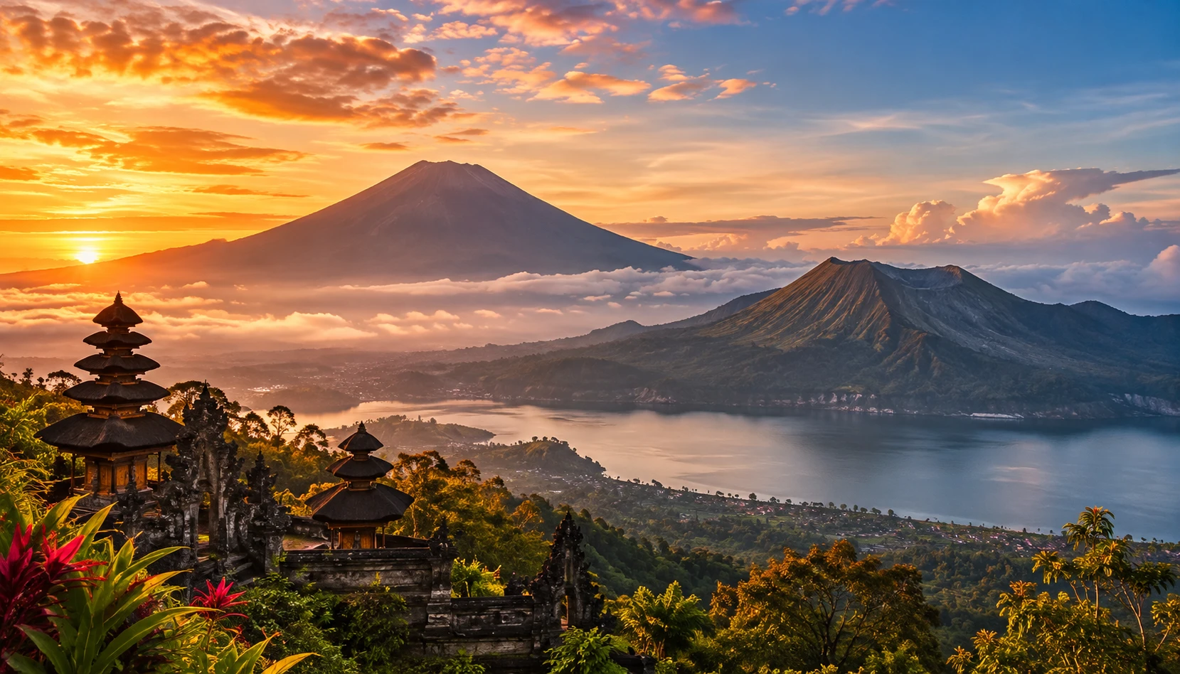
Bali's volcanoes explain much of what makes the island feel different from an ordinary beach destination. Mount Agung dominates the east with a sacred summit and steep slopes. Mount Batur rises from a vast caldera beside a lake, lava fields and villages that have adapted to living in a volcanic landscape.

The two mountains offer very different experiences. Batur is generally the more accessible introduction to Bali's highlands, while Agung calls for a demanding climb and greater flexibility. Both are active volcanoes, so current access and safety information matter more than any fixed itinerary.

Two volcanoes, two kinds of experience

Agung and Batur are often placed on the same sightseeing list, yet they demand different decisions. Agung is Bali's highest mountain at about 3,031 metres and a powerful religious landmark. Batur, at about 1,717 metres, is known for sunrise walks and its remarkable position inside a larger volcanic basin.

Choose the mountain according to your physical preparation and the experience you want. A short highland visit can include Batur viewpoints without a summit hike. An Agung ascent is a separate mountain objective, not a casual addition to a beach holiday.

Agung and Batur at a glance

The comparison below is a planning tool rather than a guarantee of trail availability. Volcanic alerts, ceremonies, weather and local access decisions can change plans at short notice.

FeatureMount AgungMount Batur
Approx. elevation3,031 m1,717 m
Typical visitDemanding guided ascent or viewpointsSunrise hike, viewpoints and lake
LandscapeSteep sacred mountainCone inside a large caldera
Planning priorityFitness, access and ceremony checksTrail access, weather and early transport

Why Bali has active volcanoes

Bali sits within the Indonesian volcanic arc, where tectonic plates interact beneath the region. Magma generated by this process has built mountains, reshaped valleys and left fertile volcanic soils across the island. The landscape visible today reflects repeated eruptions over a long period.

A quiet-looking summit does not mean a volcano is extinct. Activity is monitored by Indonesian authorities, and the practical meaning of a warning depends on the volcano and the current hazard assessment. Visitors should follow official notices rather than interpreting a clear sky as proof of safety.

Mount Agung: Bali’s sacred mountain

Agung stands above the Karangasem region and shapes the view from much of eastern Bali. For many Balinese Hindus, the mountain has profound spiritual significance. Temples, village rituals and local customs make its slopes a cultural landscape as well as a geological one.

Respect for ceremonies is part of responsible travel here. A route may be unavailable because of a religious observance even when the weather looks ideal. Ask locally before arranging transport or a guide, and avoid treating sacred spaces as ordinary photo stops.

Mount Batur: a volcano inside a caldera

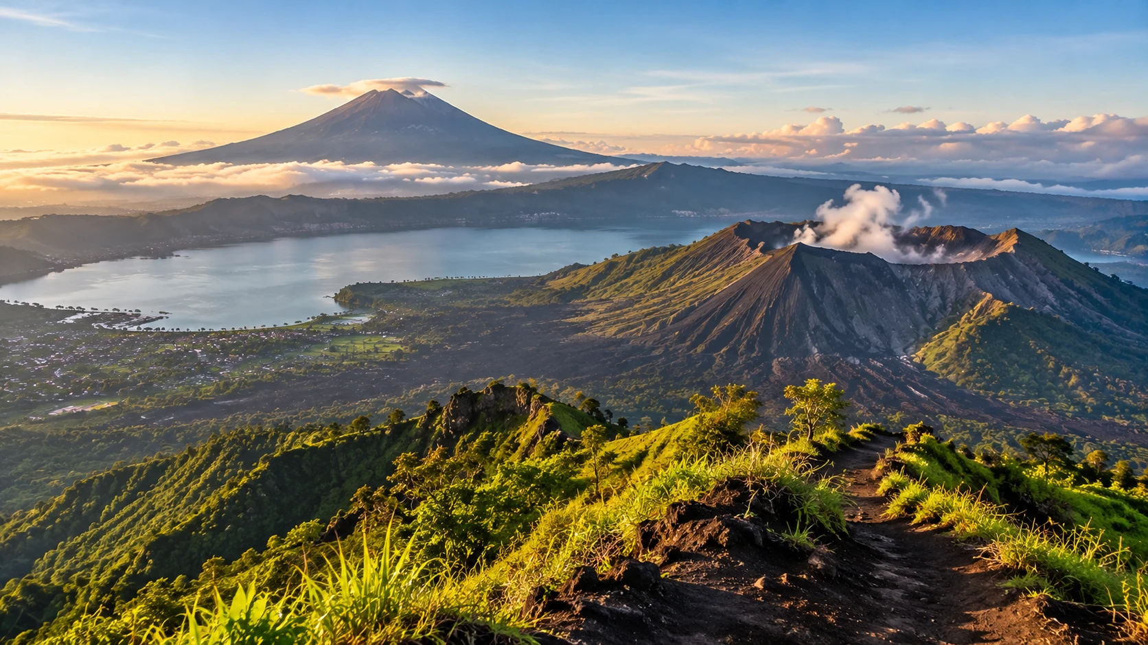
Batur is visually striking because the cone stands within an enormous caldera. Dark lava fields, farmland and Lake Batur sit within the same broad panorama. From the rim near Kintamani district, the arrangement is easier to understand than from a photograph of the summit alone.

You do not have to climb Batur to appreciate it. A viewpoint, a village visit and time by the lake can reveal the same volcanic geography with far less physical strain. This option also works when summit access is restricted.

What makes the landscapes different

Agung rises as a steep, imposing mountain above valleys and settlements. Its changing cloud cover creates dramatic views from Sidemen, Amed and other eastern areas. Batur offers a more open landscape, where the caldera wall, crater cone, lake and lava fields can often be seen together.

The most rewarding viewpoint depends on visibility. Clouds may hide Agung even when the coast is sunny. Around Batur, morning light often makes the contours of the caldera clearer, while afternoon mist can soften or obscure the view.

The Batur sunrise experience

Sunrise trips to Batur usually involve a very early departure, darkness on the initial trail and a wait near the top for daylight. Walking surfaces may include loose volcanic material and uneven steps. Tour descriptions can make the experience sound effortless, but the ascent still requires steady footing and basic fitness.

Book only after confirming the route is open and the guide arrangements are legitimate. Ask where the walk starts, what is included, how long the descent takes and what happens if weather or official restrictions prevent the climb. A sunrise photograph is never worth ignoring a closure.

Climbing Agung requires more preparation

Agung routes are longer, steeper and more physically demanding than the common Batur sunrise outing. Depending on the permitted route and turnaround point, the ascent can involve hours of sustained climbing on rough ground. Conditions can deteriorate rapidly with wind, rain or low cloud.

Agung is unsuitable as a first mountain hike for an unprepared visitor. Use a qualified local guide when access is permitted, discuss your fitness honestly and accept a turnaround decision. Some routes or summit areas may be closed independently of general access to the surrounding region.

The best season for volcano visits

The drier part of the year often offers better hiking conditions, but no month guarantees a clear summit. The highlands are cooler and wetter than Bali's southern beaches. Trails can remain slippery after rainfall, and strong winds are possible even on apparently settled mornings.

For broader trip planning, Bali’s rainy season explains how conditions vary across the island. Check the mountain-specific forecast close to departure, then decide whether a viewpoint or a guided walk is the sensible option on the day.

How cold it feels before sunrise

Travelers often leave a warm coastal hotel wearing shorts and a thin shirt. In the highlands before dawn, exposure to wind can make the air feel surprisingly cold. The contrast is strongest when you are standing still at a viewpoint or waiting for sunrise after a climb.

Pack a warm layer and a light waterproof shell. Closed shoes with grip, drinking water and a headlamp are practical for a permitted night or pre-dawn walk. A phone torch is useful as backup, but it should not be your only light source.

Volcanic alerts and access restrictions

Indonesia's volcanology authorities monitor active mountains and issue status information and recommendations. An alert can affect specific zones rather than every village in a district. Local authorities may also restrict trails for reasons unrelated to an eruption, including ceremonies or conservation measures.

Check the latest PVMBG/MAGMA Indonesia guidance and local access notices before traveling. Never enter a restricted radius, approach a crater against instructions or rely solely on a tour seller's assurance that a trail is safe. Official guidance takes priority over an old travel article.

Ash, gases and changing weather

Volcanic hazards are not limited to visible lava. Ash can affect breathing and visibility, while gases may collect in dangerous areas near vents. Heavy rain can increase risks on loose slopes and, in some volcanic settings, create hazardous flows along drainage channels.

Do not approach vents or newly affected ground for a closer photograph. If authorities issue ashfall or evacuation guidance, follow it promptly. Travelers with respiratory conditions should be especially cautious and seek appropriate medical advice when conditions deteriorate.

Getting to Kintamani and Batur

Kintamani is commonly reached by road from Ubud or southern Bali. The distance on a map can be misleading because traffic, winding climbs and stops along the rim all affect journey time. Hiring a driver for a day allows a flexible itinerary and avoids a tiring return after a pre-dawn start.

Agree on pickup location, route, waiting time and return arrangements in advance. If you plan a hike, confirm whether transport reaches the official meeting point. If you are not hiking, a later departure can still provide a rewarding visit to the caldera viewpoints.

Lake Batur and the surrounding villages

The lake is a major part of the Batur landscape, not simply a backdrop for the volcano. Villages, farms and places of worship sit around the basin, and local livelihoods are closely tied to its water and volcanic soils. Hot-spring facilities are another reason visitors stay beyond sunrise.

The guide to Lake Batur and Bali’s highland lakes gives the wider geographical context. Plan time around the lake separately from the summit, since the roads and viewpoints create a different experience from the ascent itself.

Agung viewpoints beyond the summit

You can experience Agung from the surrounding countryside without attempting the climb. Sidemen's rice terraces and eastern villages often frame the mountain beautifully. On a clear day, coastal areas such as Amed also offer memorable perspectives across the slopes.

A route through East Bali’s temples and villages connects volcanic scenery with local culture. For many visitors, these lower-altitude viewpoints are the better choice because they leave time for temples, food stops and unhurried travel.

Besakih and the mountain’s spiritual role

Besakih, the major temple complex on Agung's slopes, is central to Balinese Hindu religious life. Its position beneath the mountain expresses a relationship between landscape, worship and community that cannot be understood from summit photographs alone.

Dress appropriately and follow temple access instructions. Some areas are reserved for worshippers or ceremonies, and conditions may change during festivals. A local guide can help visitors understand the setting while respecting the people using the temple.

Planning a trip with children or older travelers

A caldera viewpoint, lakeside stop or scenic drive can work for a mixed-age group. Pre-dawn hiking is more demanding: darkness, uneven ground, wind and the return descent all need consideration. Families should resist itineraries that assume everyone wants the same physical challenge.

Match the day to the least experienced participant. Choose accessible viewpoints and comfortable transport when mobility is limited. Anyone with significant health concerns should seek medical advice before a strenuous high-altitude outing.

Photography without taking unnecessary risks

The dramatic images are often made before or shortly after sunrise, when light defines the ridges and lava fields. Yet a good photograph rarely requires standing at an exposed edge. Wind, loose gravel and crowding can turn an apparently simple viewpoint into a hazard.

Stay on permitted paths and keep clear of unstable edges. Drones may be restricted by local rules, protected areas or religious events. Confirm permission before flying and never interfere with ceremonies or rescue operations.

What the volcanoes mean for nearby property

The volcanic highlands appeal to people seeking cool air, broad views and a quieter atmosphere than the coastal resort belt. At the same time, road access, land-use rules, water management and building suitability can differ sharply from one village to another.

A mountain view is only one part of a property decision. Check the actual land designation, legal access, infrastructure, drainage and any applicable hazard guidance. A plot near a beautiful viewpoint should never be assessed solely on its scenery or a promised rental return.

Frequently asked questions

Is Mount Batur easier to climb than Mount Agung?

Generally yes. Common Batur sunrise routes are shorter and less demanding, but they still involve uneven ground and a pre-dawn start. Agung is a more serious mountain hike.

Can I visit Batur without hiking?

Yes. Kintamani viewpoints, the caldera landscape and Lake Batur can be visited without a summit ascent, subject to local access arrangements.

Are Agung and Batur active volcanoes?

Yes. Both are active, and access decisions should follow the latest Indonesian volcanology and local authority guidance rather than a fixed travel schedule.

When are the clearest volcano views?

Early mornings in the drier months often offer better visibility, but cloud and wind vary daily. Check local conditions and keep a flexible plan.

Is it safe to book a volcano tour far in advance?

You can arrange logistics early, but insist on clear cancellation or rescheduling terms. Weather, ceremonies and official restrictions may affect access.

What to Remember

  • Choose the right experience — Batur suits many first-time highland visitors; Agung demands substantially more preparation.
  • Check access before leaving — official volcanic notices, local closures and ceremonies can override any itinerary.
  • Plan for mountain weather — cold dawns, wind, rain and loose trails are different from beach conditions.
  • Enjoy the landscape without climbing — Kintamani, Lake Batur and East Bali viewpoints offer rewarding alternatives.
  • Treat location decisions seriously — volcanic scenery must be balanced with land rules, access and hazard information.

Explore Bali with a longer-term perspective

DDA Real Estate helps buyers compare Bali locations, assess access and everyday infrastructure, and shortlist properties that fit their intended use. The appeal of the highlands can be considered alongside practical ownership and management needs.

Explore our Bali properties and leave an enquiry: tell us whether you prefer mountain scenery, coastal convenience or a balance of both, and we can help narrow down suitable locations and property options.

Popular
5 June 4387635 views
Dubai Rent Prices 2025: Average Apartment Rental Costs in Dubai Dubai's rental market continues its upward climb in 2025, driven by population growth and limited new supply, pushing average prices up by 10%
#Blog DDA
8 October 2537262 view
DLD Fees in Dubai: Everything You Need to Know Buying property in Dubai? Don't let hidden fees surprise you! Our essential guide breaks down ALL Dubai Land Department (DLD) fees
#Blog DDA
23 November 2025009 views
How to Buy a SIM Card in Turkey in 2026: Prices, IMEI Registration, eSIM Options, and Best Mobile Operators Overview of mobile operators, available types of SIM cards, and home Internet providers
#Blog DDA
5 July 1870155 views
How Much is the Real Estate Agent Commission in Dubai? Find out how much real estate agent commission costs when buying property in Dubai.
#Blog DDA
5 February 1510866 views
How Foreigners Can Own Property in Bali: Understanding PT PMA (2025) Foreigners can't own freehold land in Bali, but a PT PMA (foreign-owned company) allows secure property ownership under Hak Guna Bangunan (HGB) or Hak Pakai (HP) rights
#Blog DDA
28 August 1288791 view
Oqood vs Title Deed in Dubai: Key Differences You Must Know Buying property off-plan in Dubai? Oqood registration is mandatory to secure your ownership rights.
#Blog DDA